HIKE AROUND THE NATURAL SURROUNDINGS OF GRANADA CITY
On this route, we will enjoy the natural surroundings of Granada and the most beautiful views of the city. Walking through its old town and some of the most emblematic places.
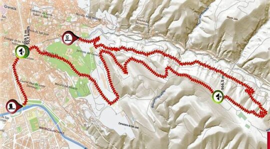
Duration: approximately 3 hours.
Distance: 12 km.
Difficulty: medium.
Minimum / maximum altitude 559.1m - 966.5m.
We will start from the Bridge over the Genil river or Puente Romano when the river Darro ends at the Genil. However, it is not a Roman bridge but Arabic, and it was built in the middle of the 12th century.
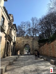
Heading towards the Carrera de la Virgen and take the Avenida de los Reyes Católicos we will reach Plaza Nueva. We will go up the Cuesta de Gomerez (1) and cross Puerta de Las Granadas. Then, we will walk left up the hill through the refreshing forest of The Alhambra.
Leaving behind the Carlos V Fountain and the Puerta de la Justicia, one of the access to the Alhambra site and certainly, of extraordinary beauty, we will go always up by the left side. The main entrance to the monument and its car park will be left on our way up as well.
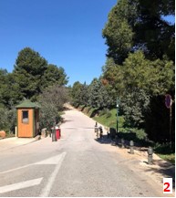
After the fourth parking lot, we take the road to the left to reach an uphill lane, to the left again (2). This lane is closed to ordinary traffic and has a guardhouse at the entrance.
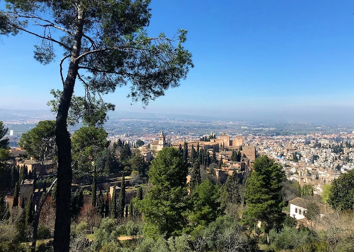
Firstly, the gentle ascent will take us to the Silla del Moro. It was a construction of surveillance and protection for the Generalife and the orchards but also, the point of distribution of water from the Acequia Real to the entire Alhambra. From its surroundings, we will have a beautiful panoramic view of the Alhambra and part of the city.
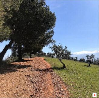
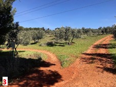 We follow the dirt road leaving behind La Silla del Moro on our left to reach a point where we enter the Dehesa del Generalife Periurbano Park taking the path on the left, between olive trees (3). We keep walking up and heading towards the left side of the hill with the ravine on the left and the olive trees on our right (4).
 At a metal gate, we take the path that runs along the left side of it to have a fantastic view of the Abbey of Sacromonte.
The route follows up the trails, between pine trees. We will see stone tables for picnics, seeing also, from time to time, and parallel to our right the road for normal traffic.
From here we will begin to see some signposting of the Acequia Real and Dehesa del Generalife route, which we will use later.
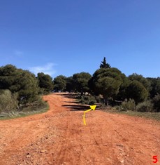
At the next crossroads, we will see a wooden post telling us to go straight up a wide dirt road, a firebreak. We will take the path on the right parallel to the vehicle lane, which runs through the pine forest, a bit stony, but much more pleasant (5).
As we begin to flatten, we will see on our left a circular stone construction, with the appearance of a fountain but which is a sundial. We will approach the sundial leaving it to our right to walk again on the left side of the mountain, continuing straight ahead towards the Llano de la Perdiz recreational area with the Sierra Nevada in the background.
We continue until we see the kiosk of the recreational area, very crowded on weekends, which has a large picnic area under the shade of a beautiful pine forest.
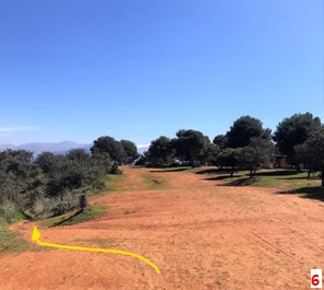
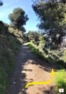
When we see a metal trash can, we will take the path that goes down to the left(6). The way down, during the first section, is stony and steep.
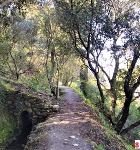
Descending we will enjoy one of the few holm oaks forests that are preserved near the city of Granada. We will arrive in a shady and cool area near the river, a beautiful forest of gall oaks. The place is perfect to rest on hot days and to listen to the bird's songs in this corner of Mediterranean vegetation.
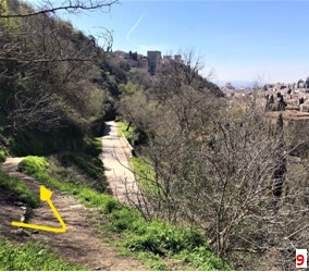
At the next trail crossings, we will be guided by the signs indicated by the wooden posts. Eventually, at a fork without signs, after about 2.5 km of walking through the Darro River Valley, we will continue along the path on the right. This descends takes us to the Acequia Real in its last section before the Generalife (7).
 The Acequia Real de La Alhambra, built during the Nasrid period, is a hydraulic engineering prodigy. It was excavated, most part of it, inside the mountain with a length of more than six kilometers. In other words, it is example of impeccable management and sustainable use of water.
 The Acequia Real de La Alhambra, built during the Nasrid period, is a hydraulic engineering prodigy. It was excavated, most part of it, inside the mountain with a length of more than six kilometers. In other words, it is example of impeccable management and sustainable use of water.
On our walk along the "acequia" we will see many "Nazari toads", reintroduced a few years ago. These amphibians are beneficial for the ecological balance of the Alhambra area. Due to their insectivorous diet, they have become a magnificent ally in pest control. In addition, they serve as food for the birds that inhabit the area.
Following the acequia (8), the path will take us to a fairly steep downhill that must be done with caution. Always using the main path, we will arrive at Paseo de la Fuente del Avellano (9). Taking it to the left we will reach the historic Aljibillo bridge and Paseo de Los Tristes.
We have reached the end of this hike around the natural surroundings of Granada City. We can return to the city center by walking along the Carrera del Darro, to our starting point. If we prefer, we can have some tapas to recharge batteries on the Paseo de Los Tristes with impressive views of the Alhambra or even go up and walk through the Albaicín neighborhood.